Gem Trek Maps

Jasper & Maligne Lake Map

$14.95
Item is in stockHurry! Low inventoryItem is out of stock Item is unavailable

Gem Trek’s JASPER AND MALIGNE LAKE MAP map is designed for outdoor enthusiasts looking to explore the section of Jasper National Park near the town and out to Maligne Lake.

Whether you are touring along the roads or heading into the backcountry, you’ll find the waterproof and tear-resistant Jasper & Maligne Lake Map to be an invaluable tool.

This map features detailed cartography, accurate hiking trails with distances, and details such as campgrounds, equestrian routes, picnic areas, and fire lookouts. On the back of the map are trail descriptions and photos of 18 recommended day hikes, four overnight or multi-day trips, and six classic mountain bike rides. Each of these described trails is referenced and colour-coded to the map on the front. Also on the back is contact information for Jasper National Park, as well for as the three backcountry lodges located in the Tonquin Valley and on the Skyline Trail.

Jasper & Maligne Lake Map Coverage
The Jasper & Maligne Lake Map covers the section of park around the town of Jasper as well as the entire Maligne Valley, including the extensive hiking and biking trail system that radiates from the town. Coverage extends from Miette Hot Springs in the north to Sunwapta Falls, along the Icefields Parkway, in the south.

Popular day hiking trails on the Jasper & Maligne Lake Map include Bald Hills, Opal Hills, Cavell Meadows, Sulphur Skyline, Devona Lookout, The Palisades, Geraldine Lakes, Maligne Canyon, Jacques Lake, Overlander, and Valley of the Five Lakes. Multi-day hikes such as the Skyline Trail, Tonquin Valley, Astoria River, Fortress Lake, Athabasca Pass, and Fryatt Valley are shown in their entirety on this map.

A 1:50,000-scale inset map on the back increases coverage of the north end of Maligne Lake, while two other insets focus on the town of Jasper and Maligne Canyon.

ISBN: 978-1-990161-07-0
Scale: 1:100,000
Edition: 9th, 2022
Folded size: 4.5 x 9.5 inches
Flat size: 27 x 39 inches

The Jasper & Maligne Lake Map includes:

waterproof and tear-resistant paper
contour lines at 50-metre (165-foot) intervals
relief shading to better show the topography
full colour on both sides
hiking trails - with trail names and trail distances marked
mountain biking trails - with trail names and distances marked
hydrology – rivers, rapids, glaciers, wetlands, and waterfalls
mountain names and all available mountain elevations
all campgrounds
points of interest and attractions
picnic areas
highway viewpoints

Free shipping on orders over $99 (oversize charges may apply) - Learn More

Fast and easy returns (no returns for final sale or heavily discounted items) - Learn more

Found a better price elsewhere? We guarantee you the best price on this item - Learn more

Customer Reviews

Be the first to write a review
0%
(0)
0%
(0)
0%
(0)
0%
(0)
0%
(0)
1930_s_Articles_de_Sports.jpg
July_2021_1_of_1.jpg

Premium gear is our promise

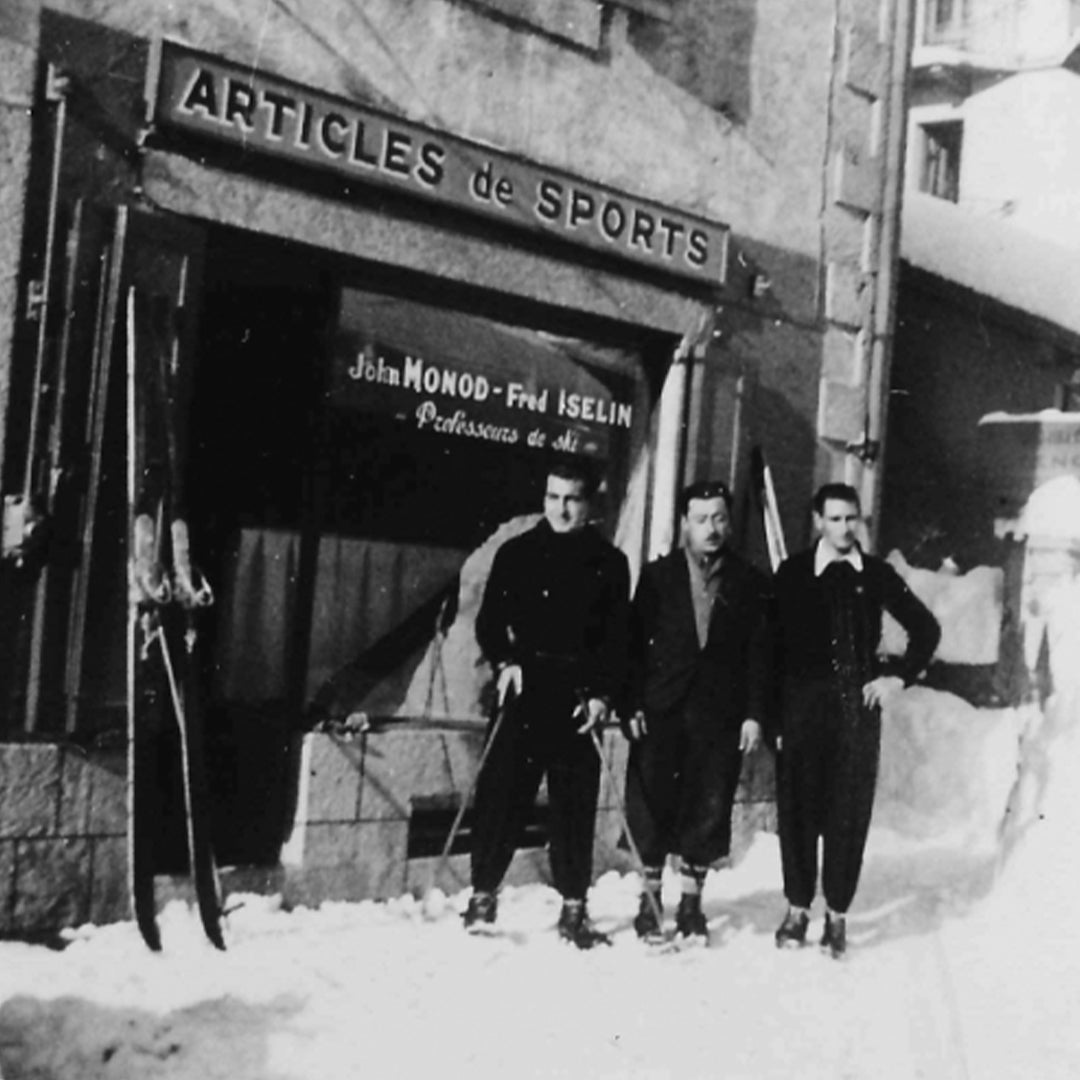
We were established almost 75 years ago by John Monod, a Swiss mountain guide and ski instructor. Quality outdoor gear is what our brand was built upon since 1949. Learn more.

Frequently Asked Questions

Have more questions? See all FAQ's