Backroad Mapbooks

Kootenay Rockies BC Mapbook | 8th Edition

$20.96$29.95

FINAL SALE

Item is in stockHurry! Low inventoryItem is out of stock Item is unavailable

Tucked into the southeast corner of BC, the Kootenay Rockies are one of Canada’s best-kept outdoor adventure secrets.

As you move west from the world-famous peaks of the Rocky Mountains, the crowds thin out and the opportunities for outdoor adventure grow. Forest-covered mountains hide sun-filled valleys, where rainbow trout swim in sparkling streams and deer graze along the shoreline. A maze of logging roads extends deep into the backcountry, offering access to countless campsites and hiking and mountain biking trails. In the winter, the region is covered by a thick layer of dry, fluffy snow, affectionately referred to by the locals as champagne powder. To help you take advantage of this incredible region, the latest edition of our Kootenay Rockies Backroad Mapbook features extensive updates and upgrades from our last publication. We have updated our road network, added numerous multi-use trails and paddling routes and expanded our Adventure sections. This Mapbook also includes updated fish stocking and trail charts, private land and labelled fish species for the countless lakes, rivers and streams in the region.

Topographic Maps: In your durable, heavy-duty, spiral-bound Kootenay Rockies Backroad Mapbook you will find 51 detailed topographic maps at 1:200,000 scale spanning the region, complete with labelled recreation sites, amenities, highways, backcountry roads, trails and other points-of-interest.

Service Directory: In addition to our maps, we list Kootenay Rockies accommodations, services, tours, and amenities.

Adventures: Our detailed adventure section is one of the features that makes your Backroad Mapbook so much more than just a map of the Kootenay Rockies. From hiking to hunting, ATVing, paddling, wildlife viewing and beyond, our team of writers and researchers have come up with the most comprehensive adventure information you will find anywhere.

Index: Divided into Map and Adventure sections, the index includes numbers and map coordinates for each activity and location, plus important numbers, distance charts and an advertiser list for easy referencing.

Pages: 224
Dimensions: 21.5cm x 28cm (8.5" x 11")
Map Scale: 51 maps @ 1:200,000
Map Features: Attractions, ATVing, Camping, Fishing, Hiking, Hunting, Paddling, Skiing, Snowmobiling, Hydrology, logging and industry roads
Areas Covered: Creston, Cranbrook, Fernie, Golden, Invermere, Kaslo, Nakusp, Nelson, Revelstoke, Trail, & more

Free shipping on orders over $99 (oversize charges may apply) - Learn More

Fast and easy returns (no returns for final sale or heavily discounted items) - Learn more

Found a better price elsewhere? We guarantee you the best price on this item - Learn more

1930_s_Articles_de_Sports.jpg
July_2021_1_of_1.jpg

Premium gear is our promise

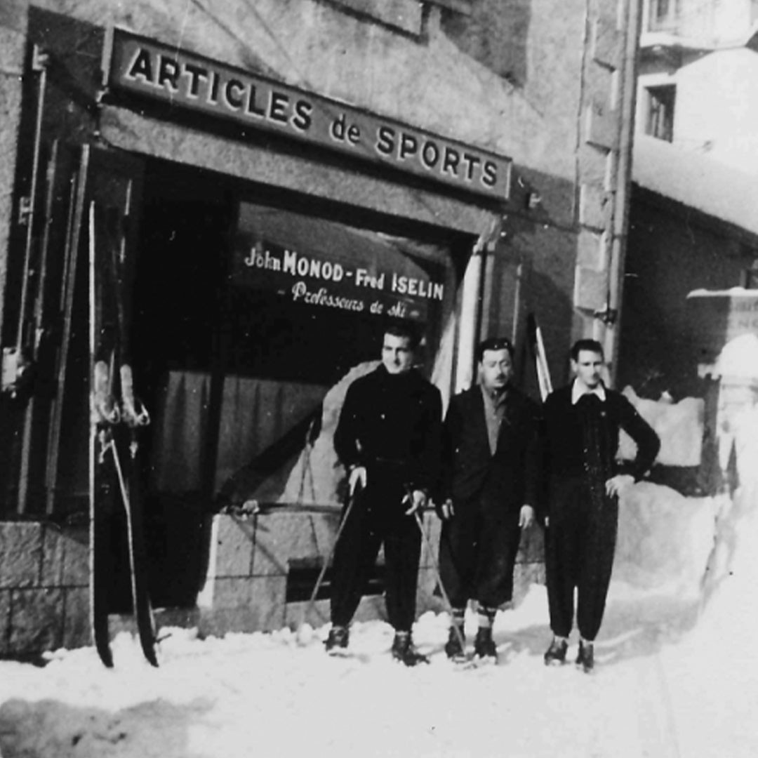
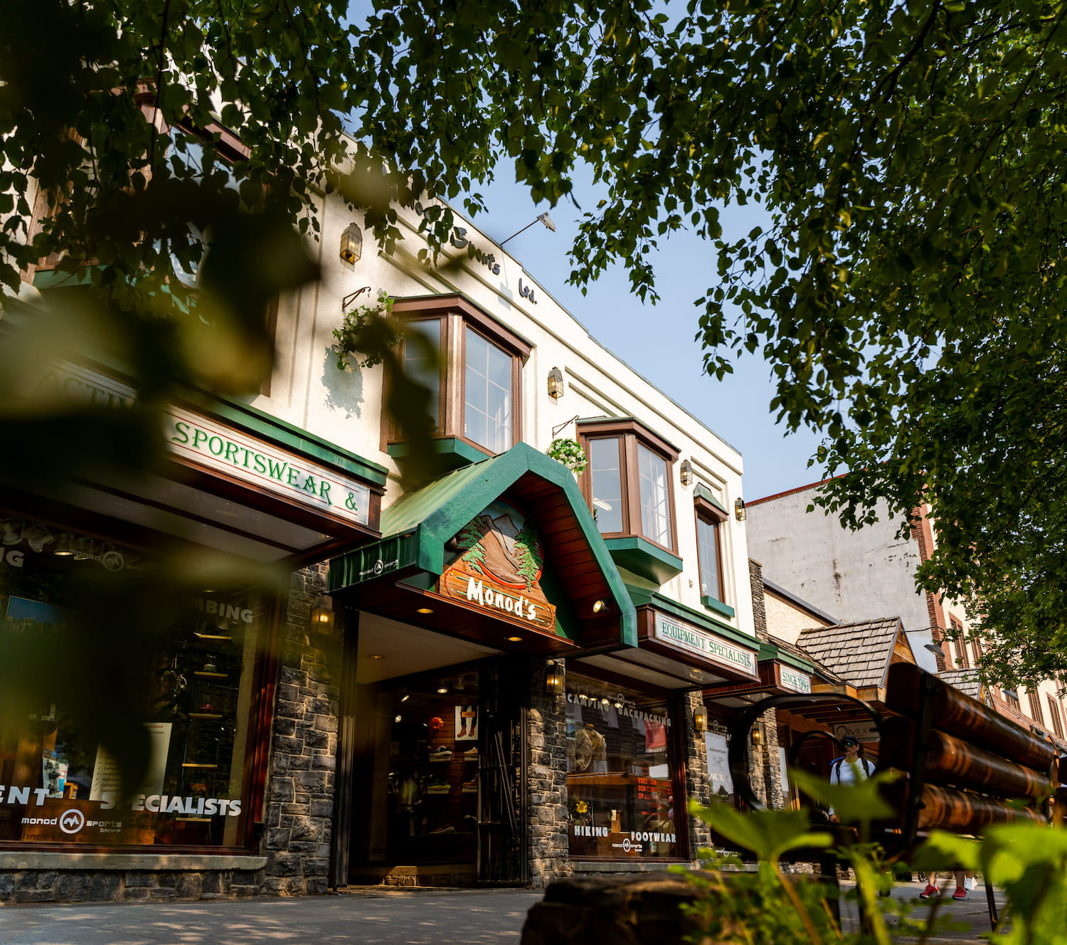
We were established almost 75 years ago by John Monod, a Swiss mountain guide and ski instructor. Quality outdoor gear is what our brand was built upon since 1949. Learn more.

Frequently Asked Questions

Have more questions? See all FAQ's